Creating a map for the future
Proof of Passion: NUS News profiles the PI of the Lab, one the University’s Presidential Young Professors.
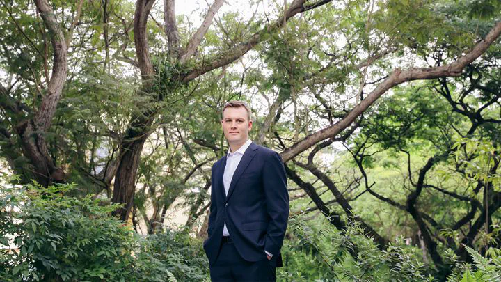 Presidential Young Professor Filip Biljecki applies his expertise in geospatial data science to help build greener and smarter cities.
The PI of our Lab, Dr Filip Biljecki, was featured by NUS in their series Proof of Passion. In this series, NUS News profiles the University’s Presidential Young Professors who are at the forefront of their research fields, turning creative ideas into important innovations that make the world better.
We thank NUS for their support and for writing about our research.
The full article is copied below.
Maps have been one of the most important ways that humans have understood the physical world. They have mediated global trade routes, decided the victors of wars and helped the construction of towering metropolises. Today, in the digital age, we can log onto our computers and point a cursor at the furthest reaches of the globe, and see a map and street view of its cities and towns.
It is not surprising that many of us assume that the world is basically known to us, and there are no more gaps in our maps to fill. However, Presidential Young Professor Filip Biljecki from the Department of Architecture under the NUS College of Design and Engineering, and the Department of Real Estate under the NUS Business School, explains that is not the case. Sometimes, the most unknown places are right outside our doors. How tall are the buildings that we see outside our windows? How many of them have rooftop gardens or solar panels? How many of those buildings receive direct sunlight or a nice cooling breeze?
Far from being trivial questions, these missing datasets hold invaluable insights for the coming age of urban planning. In the Singaporean context, Assistant Professor Biljecki points out that it is vital to know how the shape and size of buildings impact variables like energy consumption, urban vibrancy, and the microclimate. If too many buildings are in direct sunlight and do not get airflow, it is likely that more energy will be spent on cooling – leaving a bigger carbon footprint. “One of the things that we noticed talking to people who use this kind of data, but who are not currently in the field like we are, is that they take data for granted, especially the quality,” he said.
Filling the knowledge gap in modern maps
Asst Prof Biljecki, who specialises in geospatial data science, joined NUS in 2017. Here, he established the NUS Urban Analytics Lab, a research group dedicated to geospatial and 3D urban modelling, and their work aligns well with the University’s key research priorities of developing integrative sustainability solutions as well as capabilities to accelerate Singapore’s transformation into a smart nation.
Much of his work looks at plugging the knowledge gaps in our modern maps. Some of these gaps exist because data gathering is expensive. Before the advent of artificial intelligence, data gathering was done by surveyors manually, which led to huge data inequalities between different stakeholders and countries. Other problems, like the varying levels of information transparency around the world, also impact global data access. Countries that are the most impoverished are unable to use data to guide many developmental policy decisions.
To overcome this, Asst Prof Biljecki and the researchers he works with are taking advantage of modern computing techniques as much as possible. “Artificial intelligence has really brought a revolution to my field,” he said, “It has finally enabled the automatic extraction of data for a fraction of the cost of previous approaches.”
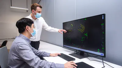
In the past, the teams that Asst Prof Biljecki has worked in have used computer vision and images from satellites or street views to estimate variables like building heights. By using this unprecedented visibility of urban spaces, researchers can now begin to fill in the blank spaces in our knowledge. In one of his co-authored papers, Asst Prof Biljecki used AI to count the number of rooftops in 17 cities that were covered in solar panels or green spaces: a testament to how far satellite imaging has come. “Geospatial technologies can help us to answer if it is beneficial to put solar panels on, let’s say, 20% of rooftops in a city. Thanks to simulations, we can estimate whether that makes economic sense and whether it makes environmental sense,” he said.
Other applications of his work are so wide-ranging that it is challenging to unify them into distinct categories. In 2021, Asst Prof Biljecki’s team published a method for characterising cooling systems in buildings just by using infrared images of the air-conditioning units mounted on the building’s exterior. Equipped with that information, people can now get a clearer picture of the energy consumption behaviour of a building’s residents. In the same year, Asst Prof Biljecki also helped to develop a comprehensive index of how ‘bike-able’ different cities are with the aid of street view imagery. Future city planners may one day use it to build more bicycle-friendly infrastructure and encourage greener transport.
Open sharing of data, interdisciplinary collaboration the way forward
Geospatial data is multimodal and multidisciplinary, and Asst Prof Biljecki prides himself on embracing the colourful nature of his research.
Datasets about urban environments unsurprisingly intersect many different disciplines. After all, a city is a nexus point where important issues meet: energy, transport, livability, smart technology, and more. Asst Prof Biljecki said he has become more multidisciplinary with each project. “Even when walking out into the city, one inevitable thing I notice is how intertwined everything is,” he commented.
In the past, he has worked with researchers with specialties from computing to transportation, and is a strong believer that this trend will only strengthen over time.
Strengthening the open sharing and use of data and resources is something that Asst Prof Biljecki feels strongly about. Much of the work he does is open-source: available for anyone to use and adapt. Increasing access to data also allows for more analyses to be conducted by NGOs, academics and corporations, many of whom are interested in the same questions.
For countries with low amounts of data, crowdsourcing is often a viable option, Asst Prof Biljecki shared, “There are crowdsourced efforts that are voluntary. People use their time and effort to map cities – one example is OpenStreetMap, the world’s largest repository of crowdsourced geospatial data.” Such crowdsourced repositories will fuel research in the future. The race to build smarter and better cities is not won by the efforts of a few, but by the efforts of many people who help each other: a democratic, communal effort.
On a foundation of more comprehensive and widely available data, the future possibilities are endless. Asst Prof Biljecki has a few predictions for what he believes the future will hold.
There are the perennial developmental issues such as the growth of smart cities and achieving carbon neutrality that he will continue to be involved in. For those, Asst Prof Biljecki believes that ‘digital twins’ could serve as an invaluable tool for future city-wide simulations. Digital twins are virtual representations of cityscapes. They can be something like a relatively simple 3D map of a city with real-time information or full models that can simulate urban micro-climates, and could help policymakers and researchers better understand how to build back greener and smarter.
More Proof of Passion stories here.
The NUS Presidential Young Professorship (PYP) scheme supports talented young academics with excellent research track records in advancing their cutting-edge research. More information about the PYP scheme is available here.