New paper: Sensing climate justice
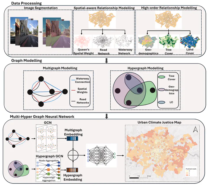
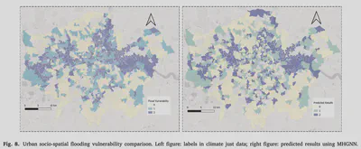
Sustainable Cities and Society publishes our multi-hyper graph approach for classifying urban heat and flood vulnerability through street view imagery.

We are glad to share our new paper:
Liu P, Lei B, Huang W, Biljecki F, Wang Y, Li S, Stouffs R (2025): Sensing climate justice: A multi-hyper graph approach for classifying urban heat and flood vulnerability through street view imagery. Sustainable Cities and Society, 118: 106016. 10.1016/j.scs.2024.106016 PDF
This research was led by Pengyuan Liu. Congratulations on his continued successes! 🙌 👏
The paper is available freely until 2025-01-31.
The code has been released openly.

Highlights
- A dual-GNN to model multifaceted spatial patterns for studying urban climate justice.
- Spatially-explicit GeoAI incorporates Laws of Geography.
- Nearly 24% performance improvement compared to conventional spatial modelling methods.
- Socio-economic indicators are crucial for understanding urban climate vulnerabilities.
- Spatial structures from multiple levels contribute holistically to the urban climate justice classification.

Abstract
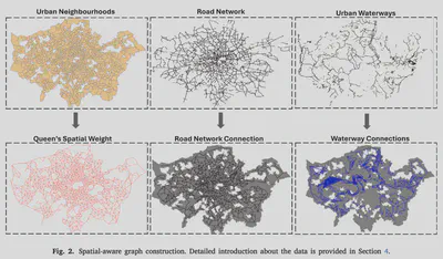
Recognising the increasing complexities posed by climate challenges to urban environments, it is crucial to develop holistic capabilities for urban areas to effectively respond to climate-related risks, forming the backbone of sustainable urban planning strategies and demanding a comprehensive understanding of urban climate justice. It requires a thorough examination of how climate change exacerbates social, economic, and environmental inequalities within urban settings, which requires a series of sophisticated spatial modellings and relies on data collected periodically. This paper introduces a novel dual-GNN approach, Multi-Hyper Graph Neural Network (MHGNN), with street view imagery as input. The proposed model integrates a multigraph and a hypergraph to model intricate spatial patterns for classifying urban climate justice. The multigraph component of the MHGNN captures spatial proximity and pair-wise connections between urban areas to assess climate impacts. Meanwhile, the hypergraph component addresses higher-order dependencies by incorporating hyperedges that connect multiple geographic areas based on their similarities, thus capturing the multi-faceted relationships among areas with comparable geographic characteristics. By harnessing the strengths of both multigraph and hypergraph structures, the MHGNN provides a comprehensive understanding of the spatial dynamics of urban climate justice. It achieves nearly a 24% performance improvement compared to conventional spatial modelling methods, establishing it as a valuable tool for researchers and policymakers in this domain. Codes available at GitHub.


Paper
For more information, please see the paper.
BibTeX citation:
@article{2025_scs_climate,
  author = {Liu, Pengyuan and Lei, Binyu and Huang, Weiming and Biljecki, Filip and Wang, Yuan and Li, Siyu and Stouffs, Rudi},
  doi = {10.1016/j.scs.2024.106016},
  journal = {Sustainable Cities and Society},
  pages = {106016},
  title = {Sensing climate justice: A multi-hyper graph approach for classifying urban heat and flood vulnerability through street view imagery},
  volume = {118},
  year = {2025}
}
