Linking Persistent Scatterers to the Built Environment Using Ray Tracing on Urban Models
Abstract
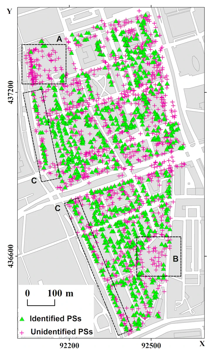
Persistent scatterers (PSs) are coherent measurement points obtained from time series of satellite radar images, which are used to detect and estimate millimeter-scale displacements of the terrain or man-made structures. However, associating these measurement points with specific physical objects is not straightforward, which hampers the exploitation of the full potential of the data. We have investigated the potential for predicting the occurrence and location of PSs using generic 3-D city models and ray-tracing methods, and proposed a methodology to match PSs to the pointlike scatterers predicted using RaySAR, a ray-tracing synthetic aperture radar simulator. We also investigate the impact of the level of detail (LOD) of the city models. For our test area in Rotterdam, we find that 10% and 37% of the PSs detected in a stack of TerraSAR-X data can be matched with point scatterers identified by ray tracing using LOD1 and LOD2 models, respectively. In the LOD1 case, most matched scatterers are at street level while LOD2 allows the identification of many scatterers on the buildings. Over half of the identified scatterers easily correspond to identify double or triple-bounce scatterers. However, a significant fraction corresponds to higher bounce levels, with approximately 25% being fivefold-bounce scatterers.