Abstract
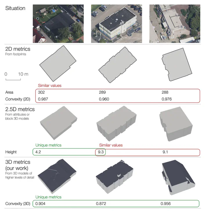
Urban morphology is important in a broad range of investigations across the fields of city planning, transportation, climate, energy, and urban data science. Characterising buildings with a set of numerical metrics is fundamental to studying the urban form. Despite the rapid developments in 3D geoinformation science, and the growing 3D data availability, most studies simplify buildings to their 2D footprint, and when taking their height into account, they at most assume one height value per building, i.e. simple 3D. We take the first step in elevating building metrics into full/true 3D, uncovering the use of higher levels of detail, and taking into account the detailed shape of a building. We set the foundation of the new research line on 3D urban morphology by providing a comprehensive set of 3D metrics, implementing them in openly released software, generating an open dataset containing 2D and 3D metrics for 823,000 buildings in the Netherlands, and demonstrating a use case where clusters and architectural patterns are analysed through time. Our experiments suggest the added value of 3D metrics to complement existing counterparts, reducing ambiguity, and providing advanced insights. Furthermore, we provide a comparative analysis using different levels of detail of 3D building models.