Abstract
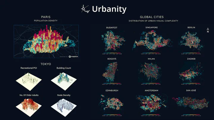
Urban networks play a vital role in connecting multiple urban components and developing our understanding of cities and urban systems. Despite the significant progress we have made in understanding how city networks are connected and spread out, we still have a lot to learn about the meaning and context of these networks. The increasing availability of open data offers opportunities to supplement urban networks with specific location information and create more expressive urban machine-learning models. In this work, we introduce Urbanity, a network-based Python package to automate the construction of feature-rich urban networks anywhere and at any geographical scale. We discuss data sources, the features of our software, and a set of data representing the networks of five major cities around the world. We also test the usefulness of added context in our networks by classifying different types of connections within a single network. Our findings extend accumulated knowledge about how spaces and flows within city networks work, and affirm the importance of contextual features for analyzing city networks.