Living upon networks: A heterogeneous graph neural embedding integrating waterway and street systems for urban form understanding
Abstract
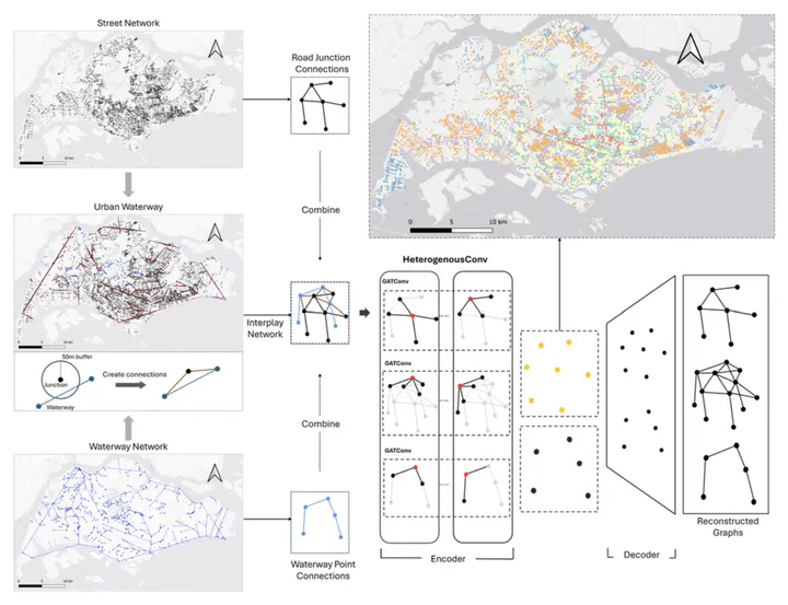
Cities are supported by multiple, interacting networks, most prominently streets, which channel movement and economic exchange, and, in many contexts, waterways, which regulate flows of goods, people, and environmental amenities. Conventional quantitative studies of urban form have tended to privilege streets alone, limiting their ability to capture the full spatial logic of the urban fabric. This paper introduces a Heterogeneous Graph Autoen-coder (HeterGAE) that jointly embeds street and waterway systems, providing a unified, graph-based representation of urban form. Using Singapore as a case study, we train HeterGAE embeddings and employ them in two downstream tasks: predicting daytime and night-time land-surface temperature (LST) and estimating resale prices of public housing. Relative to a baseline model that encodes streets only, the dual-network embeddings improve predictive accuracy by about 20% for both tasks, confirming that natural and built infrastructures make complementary contributions to urban socio-environmental processes. By capturing the interaction between street junctions and waterway nodes within a single latent space, the proposed approach provides a flexible template for GeoAI-assisted urban analytics in diverse settings. The results underscore the value of integrating heterogeneous urban networks in evidence-based planning and highlight the potential of graph-neural techniques for developing more nuanced and sustainable urban strategies.