Vertical 15-minute city: Modeling urban density and functional mix with multi-source geospatial data
Abstract
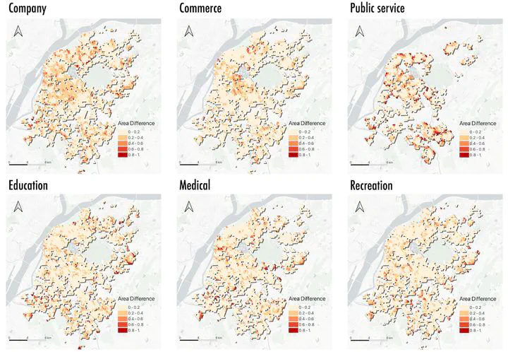
The 15-minute city concept emphasizes accessible urban living by ensuring essential services are reachable within walking or biking distance. However, most evaluations rely on two-dimensional (2D) analyses, neglecting the vertical complexity of high-density cities. This study introduces a 3D framework for assessing 15-minute accessibility in Nanjing, China. Using natural language processing and rule-based methods, we construct a 3D functional composition dataset from multi-source data. We then develop floor-level proximity indices that account for both horizontal travel time and vertical circulation (e.g., stairs, elevators). Analyzing over 90 million simulated trips, we find that accessibility generally declines with building height, though access to offices and commercial facilities improves at 20th or higher floors. Spatial inequalities emerge not only between central and peripheral zones but also across building levels and regional GDP levels, with a U-shaped disparity tied to distance from downtown. Notably, 11%–17% of trips considered accessible in 2D analyses exceed the 15-minute threshold when vertical travel is included. Our findings highlight the need to incorporate vertical space in 15-minute city evaluations and offer a scalable method to support inclusive, fair, and livable 3D urban planning with the background of 15-minute city.