GeoAI: Beyond mapping earth and cities through explainability, adaptability, and sustainability
Abstract
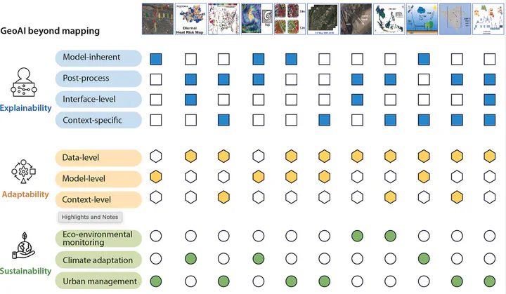
Geospatial artificial intelligence (GeoAI) is reshaping our understanding of Earth and urban systems by integrating advanced artificial intelligence techniques with diverse geospatial data and methodologies. This backstory highlights recent GeoAI advances and applications as presented in the 11 articles in the iScience special issue, “GeoAI shaping earth and cities: Advances, opportunities, and challenges.” Guest editors share perspectives on GeoAI’s advances in explainability, adaptability, and sustainability, demonstrating that GeoAI’s applications extend beyond traditional mapping functions. These 11 case studies illustrate four types of explainability, three levels of adaptability and three thematic areas of sustainability, showing the methodological diversity and practical relevance of GeoAI for Earth and urban systems. Here, interactions among these dimensions are mapped to support the evaluation and design of future GeoAI solutions. We also outline future research directions for GeoAI to address complex challenges across the sciences relating to the Earth and its cities.