Substantial disagreement between satellite- and ground-level nighttime light patterns revealed by SDGSAT-1 and street view imagery
Abstract
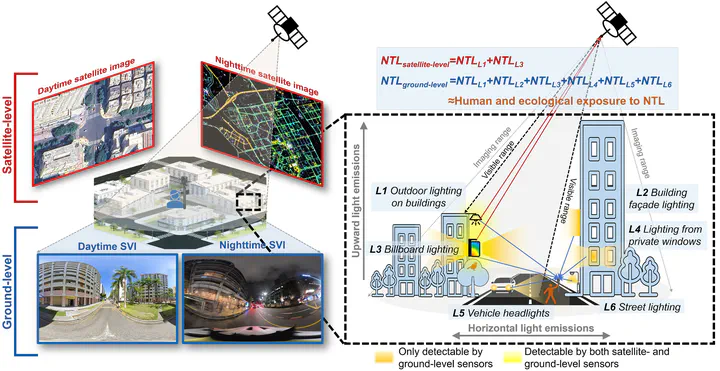
Over the past three decades, nighttime light (NTL) has become one of the most widely used and powerful proxies for characterizing human activities. Despite the recent proliferation of available NTL data from both satellite- and ground-level sensors, intrinsic differences between these two observation approaches can result in distinct NTL brightness patterns (satellite-ground disagreement). Such disagreement, particularly its spatial heterogeneity, represents a critical yet largely overlooked issue in NTL studies, introducing uncertainty into the interpretation and application of NTL observations. Here, by incorporating SDGSAT-1 glimmer imagery and panoramic nighttime street view imagery with geospatial AI approaches, we present a spatially explicit, wall-to-wall investigation into satellite-ground disagreement across Singapore. Specifically, we characterized citywide disagreement and its variation across land-use types, analyzed contributing factors, and assessed its implications for NTL-based applications, reinforced by Monte Carlo-based uncertainty quantification and sensitivity analyses using independent observations from Singapore and Shenzhen, China. Our study revealed substantial and spatially heterogeneous satellite-ground disagreement across Singapore. Relative disagreement averaged 15% ± 13% citywide but reached 42% ± 12% in 13% of the city. Such pronounced heterogeneity was likewise evident across land-use types, with commercial areas standing out for consistently significant disagreement, where ground-level NTL brightness was 29% ± 26% higher than satellite-level NTL brightness. Building morphology, vegetation canopy cover, and sensor spectral response contributed to satellite-ground disagreement, suggestive of distinct mechanisms underlying the identified patterns. Applying satellite- and ground-level NTL data yielded relative differences of at least 115% and 83% in GDP estimation and NTL exposure inequality assessment, respectively. This study sheds new light on satellite-ground disagreement by moving beyond discrete comparisons toward a comprehensive analysis of its heterogeneity and implications, thereby establishing an empirical basis for integrating NTL observations and contributing to more reliable NTL-based applications and evidence-informed policies on sustainable urbanization.

Filip Biljecki
Associate Professor