about
our research group
principal investigator
people
our doctors
our seminars
news
publications
geospatial resources
our data+code
global streetscapes
zensvi
openfacades
specs
voxcity
sp-survey
global building morphology indicators
open data SG
join
openings
why us
application guide
student initiated projects
fellowships
contact
Geoai
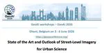
Call for Abstracts - Workshop 'State of the Art and Outlook of Street-Level Imagery for Urban Science'
An event a few of us are organising in Belgium.
Urban Analytics Lab
2026-03-01
1 min read
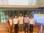
Seminar Rethinking cities in the age of AI
Full house for our latest event we organised at NUS.
Urban Analytics Lab
2026-02-06
1 min read
Introducing ZenSVI
An open-source software to facilitate the entire process of street view imagery analytics and supporting a wide range of use cases. Together with a paper in CEUS.
Urban Analytics Lab
2025-03-23
3 min read
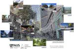
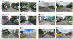
Introducing Global Streetscapes
A big open dataset with 10M images, together with a paper in the ISPRS Journal of Photogrammetry and Remote Sensing. And more.
Urban Analytics Lab
2024-07-18
4 min read
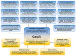
New paper: Mapping the landscape and roadmap of geospatial artificial intelligence (GeoAI) in quantitative human geography
International Journal of Applied Earth Observation and Geoinformation publishes our collaborative extensive systematic review.
Urban Analytics Lab
2024-04-11
3 min read
New paper: Microclimate spatio-temporal prediction using deep learning and land use data
Building and Environment publishes our collaborative paper that presents a new method to interpolate microclimate data at a detailed spatial and temporal resolution.
Urban Analytics Lab
2024-03-04
3 min read
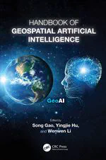
The GeoAI handbook is out and we are proudly part of it
A new consolidated effort of the Geospatial AI community and our contribution focused on Urban Sensing.
Urban Analytics Lab
2023-12-17
2 min read
New paper: Explainable spatially explicit geospatial artificial intelligence in urban analytics
Environment and Planning B publishes our position paper on explainable spatially explicit GeoAI.
Urban Analytics Lab
2023-09-29
2 min read
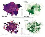
New paper: Insights in a city through the eyes of Airbnb reviews: Sensing urban characteristics from homestay guest experiences
Cities publishes our work on uncovering a new use case of a nascent form of user-generated geographic information.
Urban Analytics Lab
2023-06-06
2 min read
New paper: Revealing spatio-temporal evolution of urban visual environments with street view imagery
Landscape and Urban Planning publishes our work on a new use case of street-level imagery and its temporal aspect.
Urban Analytics Lab
2023-05-18
2 min read
»
Cite
×