about
our research group
principal investigator
people
our doctors
our seminars
news
publications
geospatial resources
our data+code
global streetscapes
zensvi
openfacades
specs
voxcity
sp-survey
global building morphology indicators
open data SG
join
openings
why us
application guide
student initiated projects
fellowships
contact
Parks
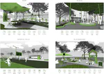
New paper: Automatic assessment of public open spaces using street view imagery
Cities publishes our work on using unconventional (off-road) street-level imagery for a new use case.
Urban Analytics Lab
2023-04-23
3 min read
Cite
×